
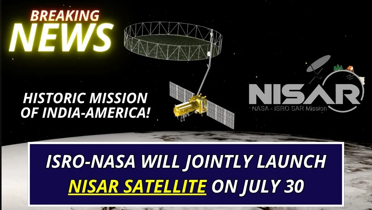
NISAR Satellite: The NISAR satellite has been prepared due to the joint project of NASA and Indian Space Research. NISAR means NASA ISRO Synthetic Aperture Rudder. It is a joint initiative of the Space Research Mission of America and India which will be launched from Sriharikota on 30 July 2025. This radar processing NISAR Satellite of 2392 kg will be as big as a bus. It is so capable that it is capable of identifying even subtle changes.
The total cost of preparing this satellite is $1.5 billion, out of which ISRO has contributed 788 crores and special contribution has been provided by NASA. This test is very important for India and America. This satellite to be launched on 30 July 2025 is going to prove to be very useful in terms of technical importance because the information given by it will be very beneficial for the earth and let us tell you that this is the most expensive Earth observation satellite till date.
NASA’s Jet Propulsion Laboratory (JPL) and ISRO have been working together for over a decade to create the NISAR mission. The satellite system has been designed, developed, and tested in collaboration with the two space agencies. ISRO claims that NISAR is able to identify even minute alterations in the Earth’s surface, including vegetation dynamics, ice sheet movement, and ground deformation. With the help of this data, NASA and ISRO hope to aid international initiatives in disaster preparedness, urbanization, food security, and climate change mitigation.
First Satellite With Dual-Frequency Radar
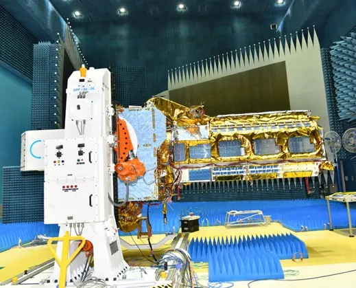
By utilizing both NASA’s L-band and ISRO’s S-band radars, the NISAR satellite will be the first in the world to use a dual-frequency Synthetic Aperture Radar. These will be integrated into ISRO’s modified I3K satellite bus and mounted on a 12-meter unfurlable mesh reflector antenna that NASA developed. The mission takes high-resolution, wide-swath radar pictures using SweepSAR technology. NISAR will provide reliable, all-weather, day-and-night coverage by returning to the same spot every 12 days, with a swath width of 242 kilometers and an imaging resolution of 5 to 10 meters.
What is NISAR Satellite’s working system?
Two types of signals are being used jointly in NISAR. Which is being called dual frequency SAR. These signals are being identified as L BAND radar and S band radar. L band which has been prepared by NASA. It will identify long waves, meaning it will go deep into trees, soil, snow and collect structural information. The same S BAND radar has been prepared by ISRO, it will work on 9 to 10 centimeter waves. It will identify surface details like crops, snow layer, soil moisture etc. In this way the NISAR satellite will collect various types of data from the earth.
Talking about the structure of the NISAR satellite, its mesh shape antenna system will resonate in 12 meter diameter which will cover a width of 242 kilometers at a time. The photos taken by this satellite will give high resolution recording every 12 days, whether it is day or night, cloudy or rainy, it will keep monitoring continuously so that the earth can know about natural disasters in advance. This satellite will receive 86 TB of data daily which will be equivalent to about 150 to 512 GB hard drive. It will be processed through a cloud based system.
L-band radar (NASA) is helpful for tracking subterranean features and environmental changes because it uses longer wavelengths to cut through ice, soil, and vegetation.
Shorter wavelengths used by S-band radar (ISRO) allow for more detailed analysis of crops, snow cover, and soil deformation because they are more sensitive to changes at the surface level.
What Uses And Applications Will Be Done With This NISAR Satellite?
This NISAR Mission Satellite, built with joint efforts of India and America, will capture centimeter level changes in the land area in incidents like earthquake, volcanic eruption, landslide, so that information can be collected in advance and alertness can be maintained. Apart from this, it will help in research by identifying the speed of melting of glaciers and their frozen process in the southern and northern polar regions.
This device will ensure analysis of parameters like forest cover production and soil moisture, which will be very useful for biodiversity, agriculture and forest conservation. With the help of this planet, flood areas in rivers, ponds, and reservoirs will be monitored. At the same time, data related to erosion process of the seashore, ship tracking, marine climate will be collected.
What NISAR will monitor?
NISAR will make extremely accurate observations of changes to the Earth’s surface. A variety of applications will be supported by the satellite. Ground deformation: By identifying alterations in the Earth’s crust at the centimeter level, it will keep an eye on landslides, earthquakes, and volcanic activity. Ice and glaciers: To help climate models, the satellite will monitor the movement and melting of the polar ice sheets.
Agriculture and ecosystems: It will evaluate alterations in vegetation patterns, crop growth, and forests. Hydrology: For the purpose of managing water resources, it will monitor changes in surface water and soil moisture. Disaster response: Emergency response to calamities such as floods, cyclones, wildfires, and tsunamis will be facilitated by real-time data. Maritime and coastal surveillance: It will keep an eye on ship movements, sea ice, and coastal erosion.